12WeekGeoChallenge
August 04, 2024
Inspired by the 30DayMapChallenge, friends and I created our own 12WeekGeoChallenge, where we have one week to create a map on a specific topic. I mostly used ArcGIS Pro, as well as the Affinity suit for drawing and creating own symbols etc.
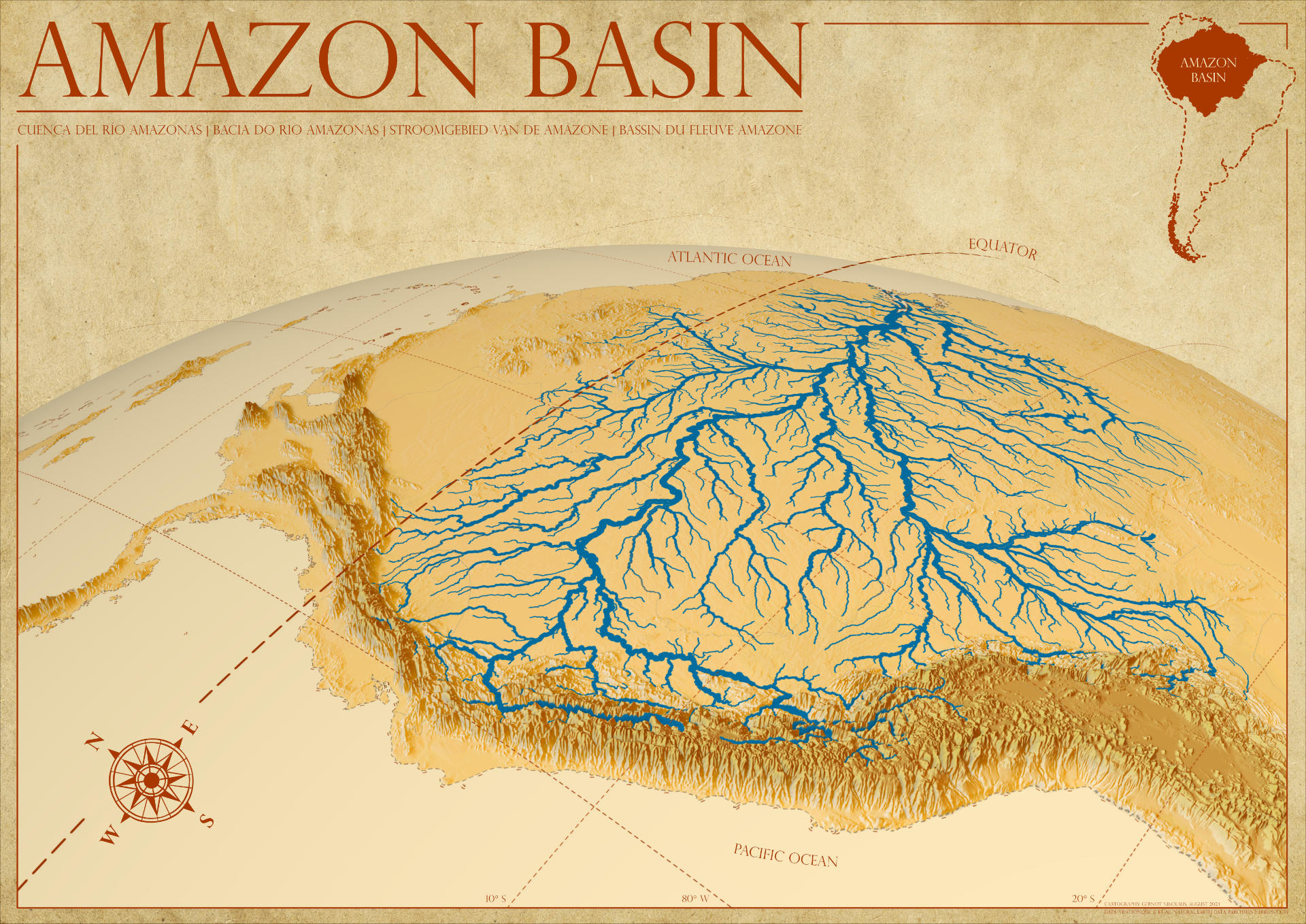
Topic 01: river networks/water bodies 🗺️ Map of the Amazon Basin
Topic 02: Animals in the wild 🗺️ Map of the Rock Monitor in South Africa
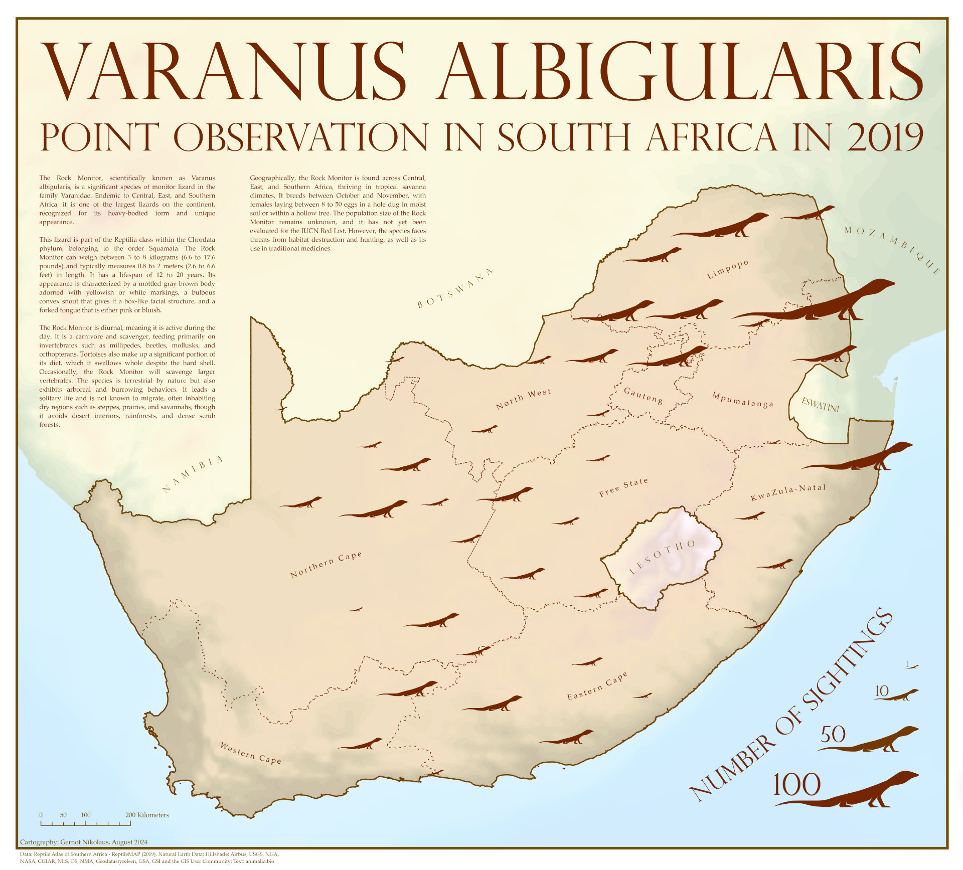
#AnimalsInTheWild was the second theme of our #12WeekGeoChallenge! The map shows the number of sightings of the Rock Monitor Lizard (Varanus albigularis) across South Africa in 2019 - no more information needed, just the distribution.
Topic 03: Local Landmarks 🗺️ The Great Wall of China
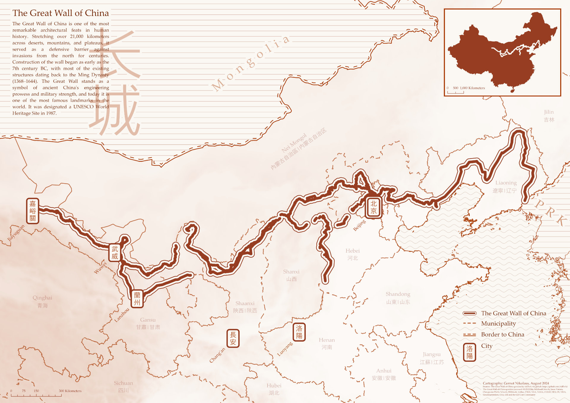
Showcasing the third map for our #12WeekGeoChallenge, focusing on #LocalLandmarks. This one highlights the iconic Great Wall of China, capturing its incredible span across the country - while sticking to a single-color theme.
Topic 04: Minimalist Map 🗺️ Mountain Peaks Prominence & Shinkansen Train Line of Japan
For the latest topic of our #12WeekGeoChallenge, focusing on #MinimalistMaps, I created two maps showcasing iconic aspects of Japan.
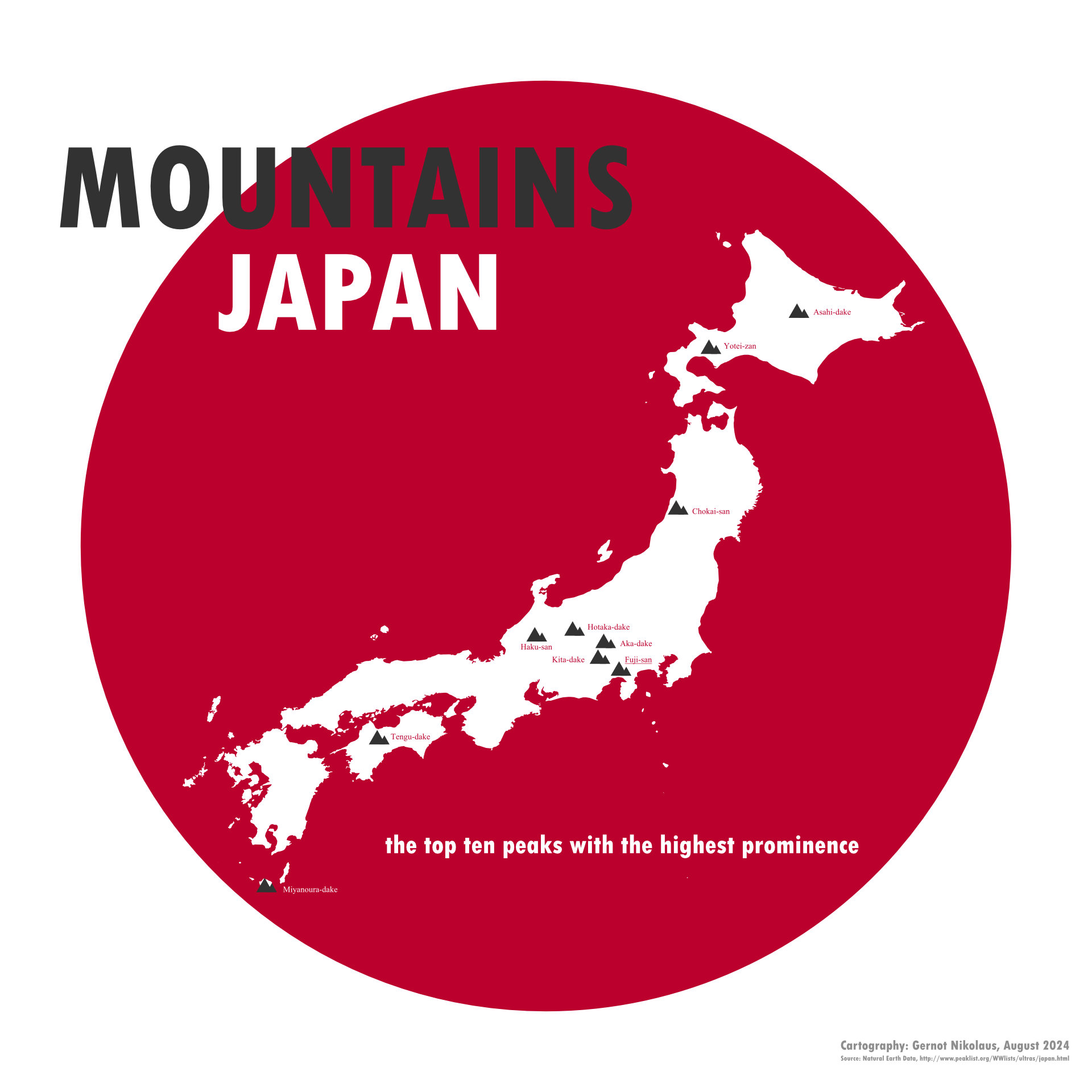
First of all, the Mountains of Japan: Highlighting the top ten peaks with the highest prominence across the country, with a bold, single-color theme.
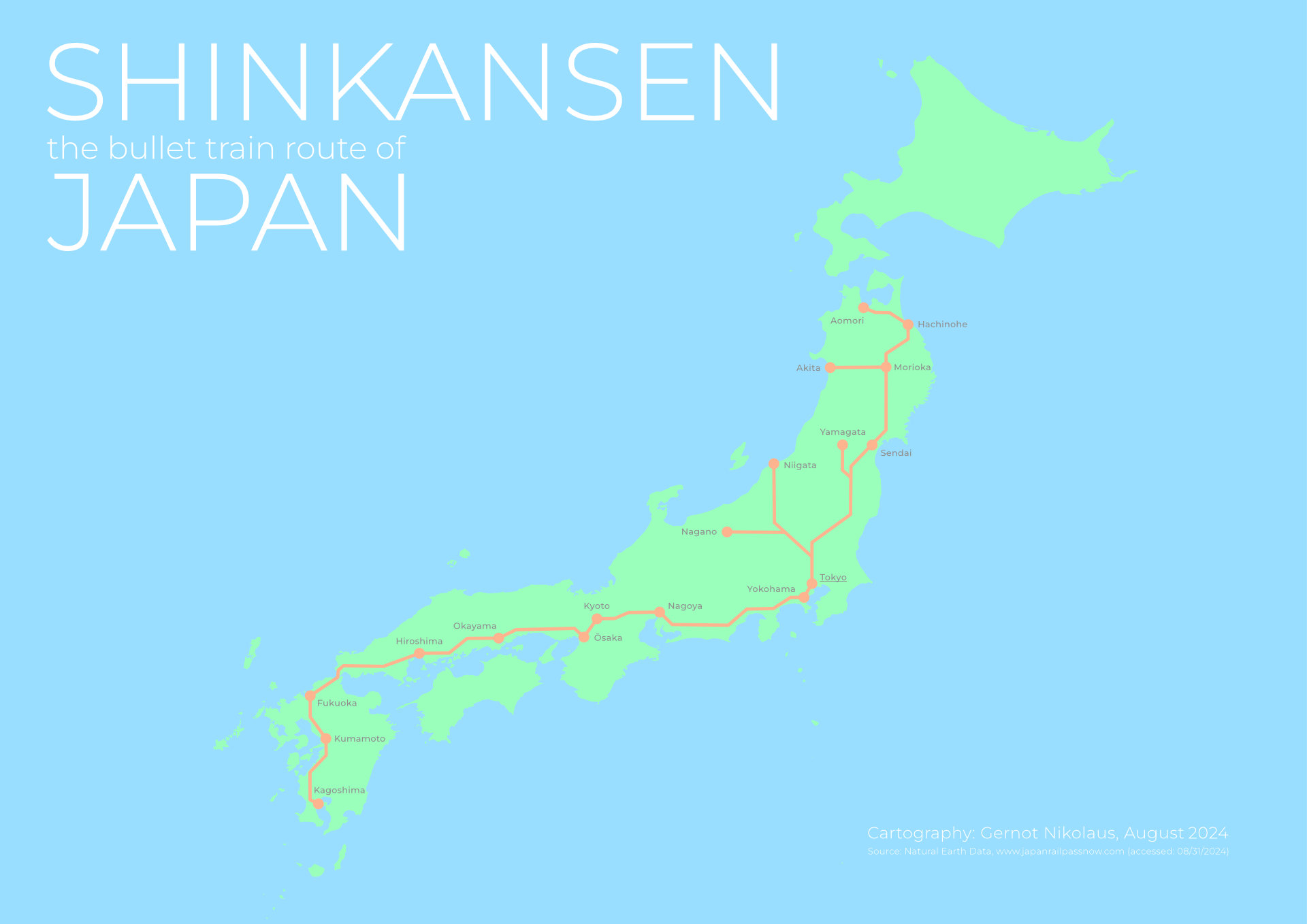
Secondly, the Shinkansen Speed Train Lines: Mapping Japan’s famous high-speed rail network, keeping it simple and clean.
Topic 05: Creative Lines 🗺️ Cyclone Activity in Northern Queensland, Australia (2000-2020)
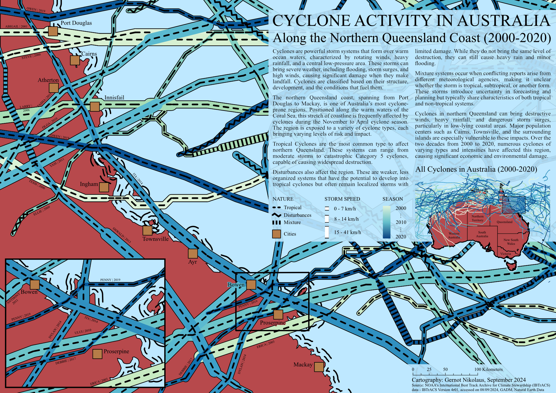
Showcasing the fifth map for our #12WeekGeoChallenge, this time focusing on #CreativeLines! This visualization captures cyclone activity along the northern Queensland coast from Port Douglas to Mackay over two decades. I know some areas are quite data-dense, but I wanted to take on the challenge of representing three different attributes within a single line symbol: nature (type of storm), season, and year.
Balancing multiple variables while maintaining clarity was an exciting cartographic experiment. I hope this map conveys both the frequency and complexity of these storm systems in the region.
Topic 06: Travel/Adventure Route 🗺️ Magellan’s Circumnavigation | 1519-1522
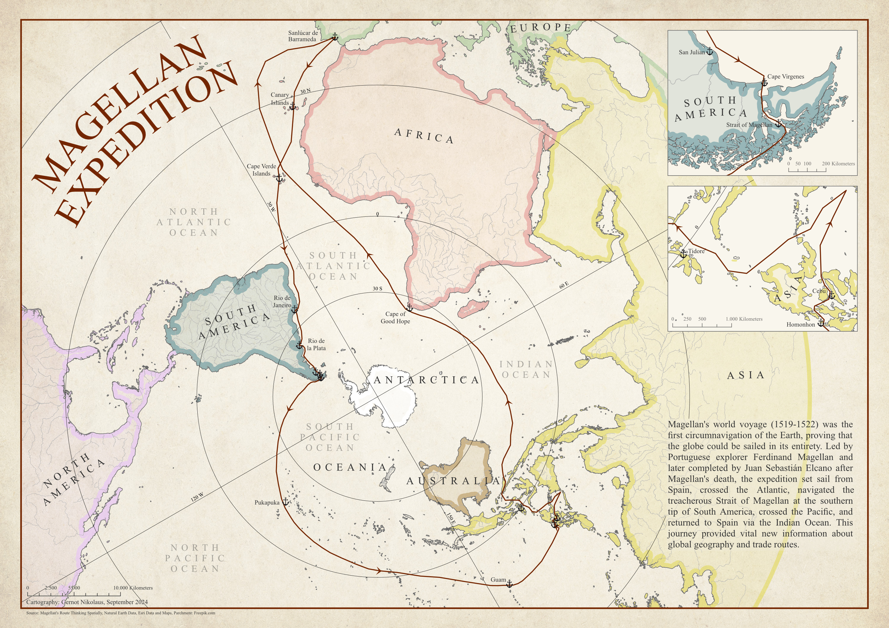
Presenting the sixth map for the #12WeekGeoChallenge, themed around #TravelRoute! This map traces the historic journey of Ferdinand Magellan and Juan Sebastián Elcano, known as the first successful circumnavigation of the globe. The route covers key stops from Spain, across the Atlantic, around the Strait of Magellan, across the Pacific, and back via the Indian Ocean.
For this map, I chose to experiment with a polar coordinate system to center the entire journey.
Topic 10: Unexpted Map 🗺️ Cycling from Germany to the Asian Continent
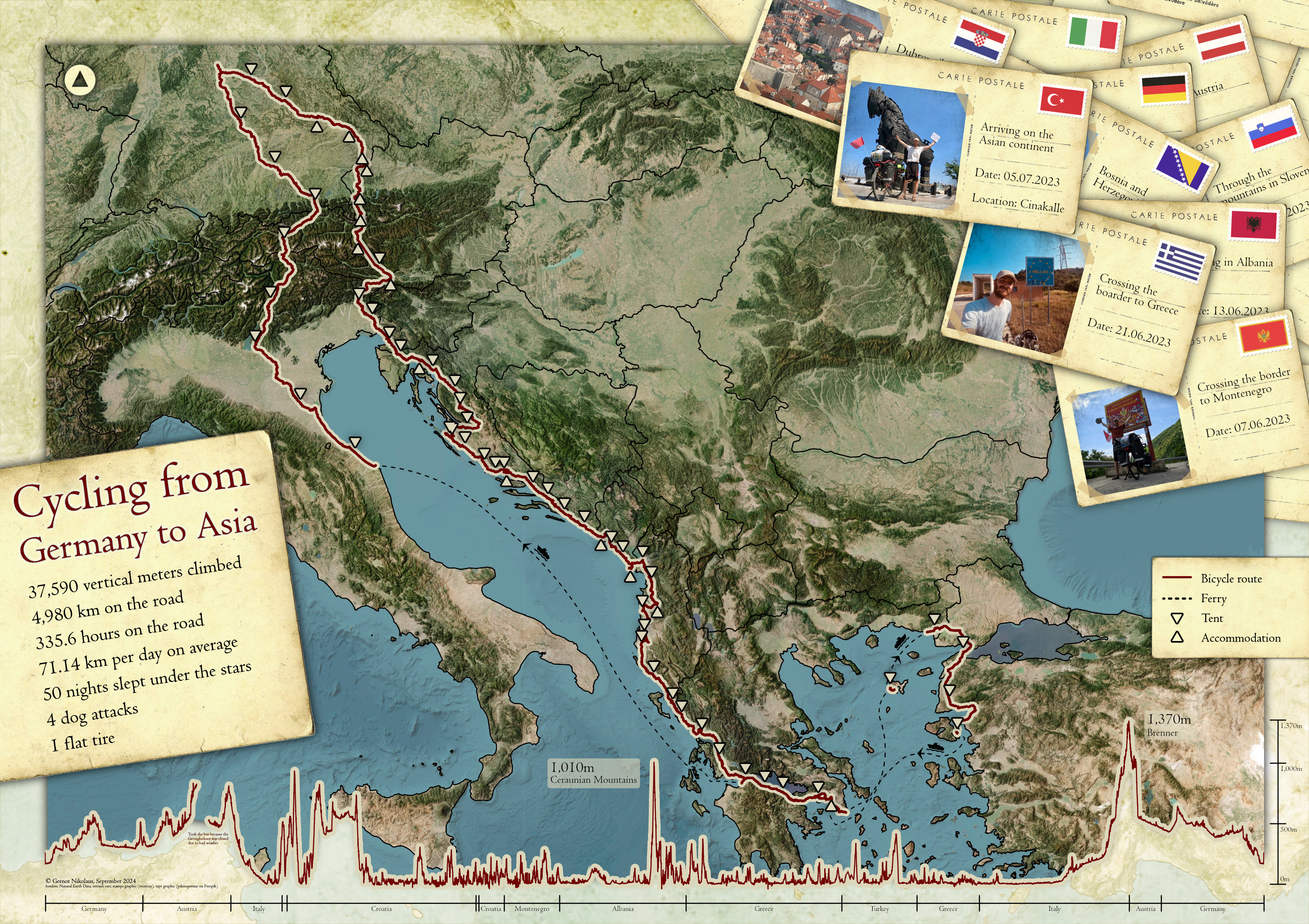
Excited to share my latest map, which visualizes my cycling journey last year from Germany all the way to Asia! I wanted to represent the elevation changes (bottom part), route progression, and key moments - such as where I set up my tent or stayed in hostels - while also providing some key statistics from my almost three-month adventure.
More details about the challenge and other maps will be added soon!